Wednesday:
- Woke up at 05:35 and got ready.
- Went to Lakeview Restaurant for breakfast, where I had the "Fisherman's Breakfast", only replacing eggs with sausage patties. The waitress said that she couldn't replace them because sausage costs more than eggs, but that she'd take $2 off the meal and add the add-on price for the sausage. I've never seen anyone do that before... It was the only breakfast that mentioned it included walleye, which is the famous fish in the area. It's the best fresh water fish I've ever consumed. Everyone that worked here had the stereotypical upper-midwest accent like they did in the movie Fargo, and ever since then everyone I've spoke with had either that accent or a Canadian accent (which is similar, but a little different).
- My next stop was the local grocery store, which confirms the almost-unreal honesty of the people here - it's the only small town grocery store I've ever seen that didn't have outrageously-inflated prices. I picked up spare batteries just in case I needed them (didn't, but since the ones I had were half-depleted, it was prudent).
- The border crossing was just as crappy as every US/Canada crossing I ever make into Canada in a car... I guess I totally bungle the answers on those crossings...or it could be that every time I cross in a car I have a completely-improbable story. "What is the purpose of your visit to Canada?" "To go to the northernmost point in the continental United States." "Why do you need to enter Canada for that?" "It's at the top of the Northwest Angle." "Do you know anyone in The Angle?" "No"...it just went downhill from there. (Ex: "Where do you live?" "California."..."And you came all the way up here for that?" "Yes"..."Could you please pull off to the right." ... when she meant left, so I got all screwed up. They held me for a little over a half an hour as they rummaged through absolutely everything in my car, checked my passport carefully, looked for warrants, DUIs (they asked me where I lived other than CA, and I got nervous, thinking I might get mistaken for someone else by name only), etc. They dug through and messed up my luggage, looked through the pictures on my camera, searched my laptop and laptop bag, and rifled through every part of the car. I suppose a guy carrying next-to-nothing, with an improbable story, a Saudi Visa, a car far too nice for where they're headed, from another state, in a car with plates that do not match where they're from, etc, etc, etc, is going to be bothered. I'm sure people like that are actually the least likely to be up to something...
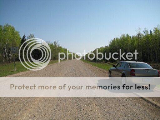
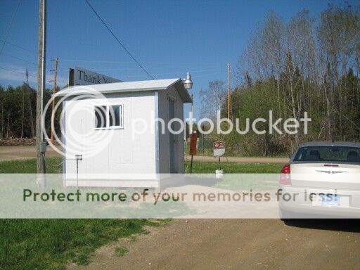
- After that ordeal, I forgot where I was going, so I had to go back in and ask directions. They gave me a map and asked me if I knew that I needed to check in at Jim's Corner. I told them I did, and showed them the paper I took from their wall earlier that explained the process. They also informed me that the road was gravel starting just beyond Moose Lake Provincial Park... I wasn't aware this would be a semi-offroad adventure. The gravel road was suitable for highway speeds, though, just as they told me they would be.
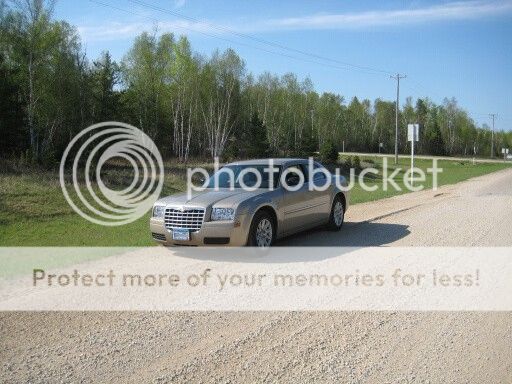
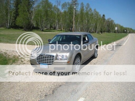
- I stopped just before the gravel section and shot some pictures of the car, signs, etc. I got a lot of pictures of signs, animals, the car in various states of unclean, and scenery.
- Saw a lot of animals out there: Deer, beavers, birds of all kinds, walleye, yetis, and quite a few unidentified animals.
- Checking in with the border patrol was entertaining. I mean, what are they going to do if they think you're crazy or don't want to let you back into the US? Especially over a video phone... I talked to her for a while and she didn't seem to be believing me, then she turned on the videophone and asked me more questions, as well as checking my passport with a special high-res camera on the videophone thing. They let me in...but, again, what else could they do?
- After getting into The Angle, I found everything almost completely dead. People live here, and a few were out, but overall the area looked practically abandoned (aside from the fact there were houses). I eventually happened upon a bar and grill place, where I asked if they knew of anywhere I could rent a boat. They said it was a little too early in the season, but if I went all the way to the opposite end of the top of The Angle that there was a place that generally rents them.
- Wandering back, I missed my turn and found myself outside "Jake's Northwest Angle Resort", which looked promising. Either they'd have a boat to rent or know someone that did, so I went inside and found the office, which was deserted at 10:20 in the morning. Some people in a boat at the dock waved to me, I walked over to them, and they told me the owners live over in the end house, but that if I pushed the doorbell on the office that they'd come down. I did so, and about five minutes later a lady by the name of Karen with that upper-midwest accent came out in a golf cart to help us. She asked me what brought me there, and I told her I was looking to rent a boat to get to the northernmost point in the continental United State. She said they have one, but it might not be possible to get to "The Wagon Wheel", showing me a map and mentioning that we need to consult her husband about getting out there. She then excuses herself to help the people in the boat. When the man in the boat came back out of the office he said "good luck, I hope you make it" in a thick French-Canadian accent.
- Her husband, Paul, pops by in a golf cart about ten minutes later as we're reviewing the maps some more and talking about the difficulty of getting there due to the shallow water and the fact there is only a small channel making it up to the point. He says that it might be possible, but he can't guarantee anything, that I'd never be able to follow the channel, but that we needed to try considering how far I came to get up there.
- He also mentions that it is the nicest day so-far this year, and last week it was snowing.
- Luck was with me, as they had exactly one Lund in an operational state and his duck boat. A duck boat is a thin, shallow-draft boat with a wide center that is well-suited for playing in the reeds where you'd find ducks, while also being very stable for standing in/on while shooting. Paul said he'd try to get me there, if it was currently possible, and that he was pretty sure it was as long as you remained in the channel. While I was collecting my equipment, protective clothing, drinking a bit, and hitting the restroom before we go out, he quickly assembled the boats and equipment we needed to get out there.
- We load into the Lund along with Bud (their dog), and start on our short trip of roughly five miles to the northernmost point in the continental US.
- On the trip over, we took a very curvy route across what appeared to be a large inlet as I chatted with Paul...
- Usually the reeds are in the shallow water, and people seldom go up there when they're not up yet. Before leaving, he said if we weren't back in a few hours, we were probably limping back in the duck boat with the tiny outboard because we ran the Lund into something.
- What I learned is that the lake looks quite different from it's appearance when the survey was made that set the border. At that time, the water level of the lake could fluctuate far more than it does today, and it was lower at the time of the survey. The point is actually a small rise in the bottom of the channel that coincides with the depth of the lake at that time. After they dammed the Winnipeg River, they have maintained the lake level above that, so you can't actually set foot on the ground they once stood on when the boundary location was set without getting wet, because it's in about 2-3 feet of water. Instead, the lake extends up into a marsh area that was once dry land surrounded by marsh.
- We talked about quite a few different things that had little to do with the project, but were interesting. I was somewhat surprised by the broad array of subjects he knew beyond local information. He told me about most of what I mention above regarding the point, plus some research I did on it afterward. One thing mentioned he mentioned that I need to remember is a hope for more border crossing checkpoints.
- On the way over we saw a bald eagle nest. As is the custom, this nest was in Canada.
- When we run out of channel, Paul anchors the Lund about a half a mile from the point, draws the duck boat in, and we load in with Bud to make the last short stretch to the point.
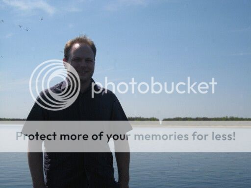
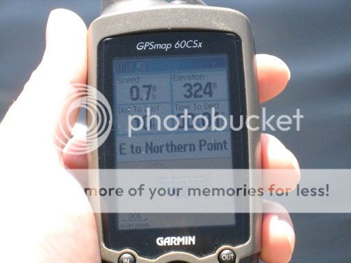
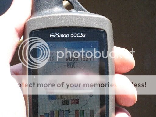
- We carefully approach it, and thanks to the really flat land and lack of trees, my GPS is reporting +/-11 feet of accuracy, and we drift within 5 feet of it a number of times. I shot a picture of the GPS as we were coming in, then another after we had drifted a bit off of the coordinates it was giving because I couldn't get my camera to focus due to reflections and settings. I did get one a handful of feet off from the exact point, though, which is pretty close. My track log should show that I passed over the exact spot at least once, and it was within the range of accuracy in any case.
- I stood in two provinces and one US state north of the 49th parallel at once. The only other place you can do this is on a glacier.
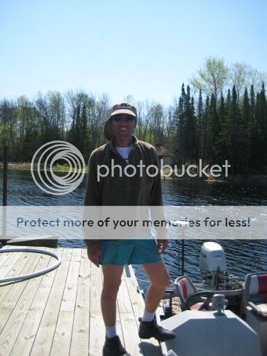
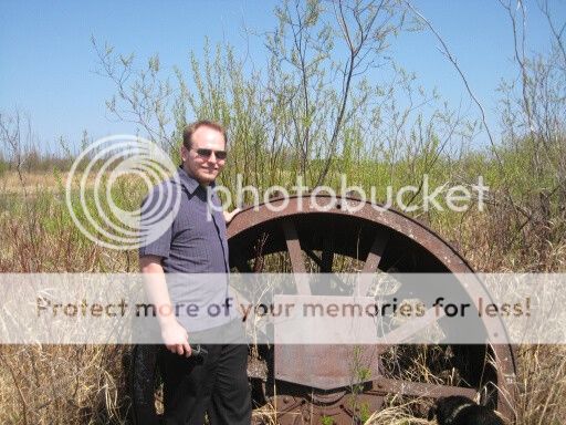
- After we took some pictures there, including two of me standing at the front of the boat with the cut in the trees behind me, we headed further up to the "Wagon Wheel".
- The "Wagon Wheel" is actually a huge metal tractor wheel that someone tossed on a piece of land that sticks out from Ontario near the point.
- Getting in here was more difficult than even the point itself, and the little boat was definitely the only way it could be done. He poled the boat in the last little bit through the reeds up next to the wheel itself, where I hopped out and got water in my shoe before walking over to it, where he took a few pictures of me.
- Bud enjoys a run around in Ontario near the wheel while we're there.
- We return to the Lund and cruise back. The entire trip time was about an hour and a half.
- I stop by a little restaurant that I noticed earlier and get a burger. The place was completely dead because it's so early in the season and the middle of the week, so I chat with the waitress while eating. We mostly talk about the weather and border patrol, which drives just about everyone up there nuts. I learn that odd things do happen out there because it's such a remote border region, but that it is rare. She grew up in Warroad, which is where I stayed the night before.
- I heard someone say "uff da" today, which I learned in my research about the area.
- After returning to Jim's Corner to check in with Canada again, they pointed out that I hadn't been up there very long and seemed annoyed. After some more questions they gave me a number and told me to provide it if asked.
- Driving back, I picked up two bottles of Canadian Mountain Dew and two Coffee Crisps - a couple things you can't get in the US.
- At the US border checkpoint they ask me what the purpose of my trip was, and apparently they had heard of me. They riddled me with questions and asked me weird things that made no sense or made comments that didn't add up that I corrected. Once that was over and they had searched my trunk, they sent me on my way. This is the first time I have ever been thoroughly checked at a US border checkpoint. I swear it must be the car, because I don't think they bother guys in pickup trucks that look normal.
- Back in Warroad, I book my next hotel, get directions, buy hand-collected and traditionally-processed wild wild rice, and fill the auto with petrol.
- The trip back had at least one error. Google sent me along these crazy county roads that were very confusing to get to Bemidji (where I am now). Most were almost perfectly straight and went on for miles like that. One went on dead straight for at least 15 miles. That was possibly the most fatiguing thing ever...
- The surface of the earth is all-but flat out there, which makes these perfectly-straight roads possible.
- Many county roads have the same numbers but are in different counties. When you move between counties the number usually changes without telling you. The number of counties I crossed makes this very confusing.
- Crossroads with important county roads are no better marked than crossroads for dirt county roads. If I had known that, I would have set a route in my GPS to follow them. They weren't on the basemap, but Google and my waitress in The Angle told me that was the shortest/fastest route to take. It was over three hours shorter than the route the GPS gave me.
- Ate some wild rice with dinner, since it was the only non-potato starch option on the list of sides. Good stuff, but I have no clue what some of the grains in there were.
First pictures to follow...
 I'm just hoping you had fun here. And that I didn't hit you too hard with the pillow.