First off, Colors, I want to commend you for having the courage to explain your own model of the way things work. So far you’re the only one.
Let’s put the theory to the test:
If I read correctly, the theory is that the seasons come about because of the elliptical orbit of the earth and the tilt of the earth’s axis of rotation. Though it is not entirely clear how tilt overrides the “elipseness.”
It seems you actually have two mechanisms at work in your theory, but ultimately only one of them mattered in your explanation (the tilt). Both hemispheres travel together in orbit, but one will have winter while the other has summer and vice versa. It is the tilt of the earth’s axis that determines which one has summer and which one has winter.
The perihelion (the closest point to the sun) in Earth’s orbit is 147 million kilometers from the sun, and it happens in early January right now. The aphelion (the furthest point from the sun) is152 million kilometers from the sun. That is only a 3.4% difference.
The earth’s diameter is 12,715.43 km. That’s less than 1/100th of 1% of the distance from the earth to the sun. The tilt, even if it moved a hemisphere one full earth’s diameter closer in summer vs. winter (of course, that would require a 90 degree tilt) it would still be more than a 100 times smaller than the difference between perihelion and aphelion.
So seasonal temperatures as a function of distance from the sun is looking highly arbitrary.
There are a lot of theories thrown around. Jonathan Drori mentioned something about the rays from the sun being “more spread out.” I am not sure what he meant by that, but that can be quite misleading. The angle made by 1/10000 (Earth’s diameter over the distance from the sun) is less than 0.006 degrees—the rays from the sun are going to be virtually parallel to each other.
The theory I find most plausible is the following:
The bottom line for the changes from season to season is the average daytime temperature. This depends on the amount of heating that the earth receives in a single day throughout the year, and this depends on how many hours the Sun is above the horizon and exactly how long it spends at its highest elevation above the horizon. For every square meter on the surface of the earth, it will be heated by the Sun at a rate that depends on the 'cosine' of the angle of the Sun above the horizon. The higher the Sun gets, the less slanted the rays of light are that intercept each square meter, and so the efficiency with which these slanted rays can deliver energy to the surface gets better and better the higher up the Sun gets. When you add up during the daylight hours just how much heating this surface gets, it receives most of its heating from those times during the day when the Sun is the highest above the horizon. For a tilted earth, there will be some days during the year at a given latitude, where this heating rate is the highest and we call this summer. There will be other days when the Sun never gets very high above the horizon and so its heating ability is very low, and we call this winter. The details of just how hot and cold we get, and the exact dates, depend also on whether we are near water, or in the interior of a continent.
So, seasonal changes depend on the tilt of the earth's axis because they lead to changes in the amount of heat delivered to a square meter of surface, and the fact that there are a changing number of hours in the day when the Sun is above the horizon and high enough up that it can efficiently heat the surface over the course of a typical day.
source:
Earth's Axial Tilt and the Seasons
Even though this is a crude approximation, if we assume a spherical Earth, and that the equator an poles are aligned to the axis of rotation, we can get an approximation of the angle of incidence of the sun rays hitting the earth based on the latitude.
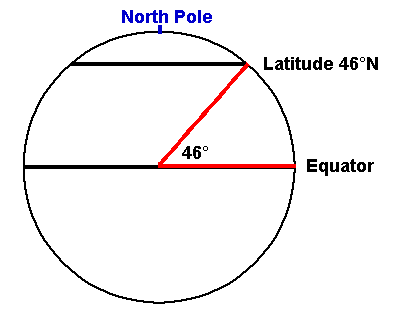
Latitude is the angle from the equator to a point on the earth with the vertex at the center of the earth. Here is a diagram showing the definition of latitude:
First we’ll just look at the problem in two dimensions. Of course if θ-23.44>90 or θ+23.44>90, then we would be in complete darkness for the season.
Now, we really only care about the cosine of the angle between the line parallel to sunlight and the vector going from the center of the earth to the location in question.
Let’s say Φ, is the angle we care about and φ is the angle we turned along the axis from the 2D picture, then
in summer, and
in winter.
Note if we integrate across the time the given point is exposed to the sun, and divide by the maximum intensity we could get from the sun, we’ll find a fraction of the sun light we could get (if the earth wasn’t spinning):
, plus for winter, minus for summer.
I can provide more detailed derivations if you want (even though it is unlikely to be original, these equations are my own thoughts).
The equations for the fraction of sunlight used based on latitude fall out quite naturally. There are still many steps before getting a fully testable model based of the qualitative theory described, but it matches common experience at a cursory level—as latitude increases the fraction gets smaller.
Regarding your other questions, I think it would be more illustrative if people pitched ideas that could be wrong. I have my own thoughts, but I have a fairly high confidence in being correct.

 I was on the run to class... I figured it was a concept better explained using diagrams anyway- plus diagrams mean not having to look up how to spell long words or feeling guilty about not actually looking stuff up.